ForeFlight Mobile EFB
ForeFlight
3.8
Advertisement
Advertisement
Download for a 30-day free trial of our top subscription plan! Visit our website for more information on available plans and add-ons.
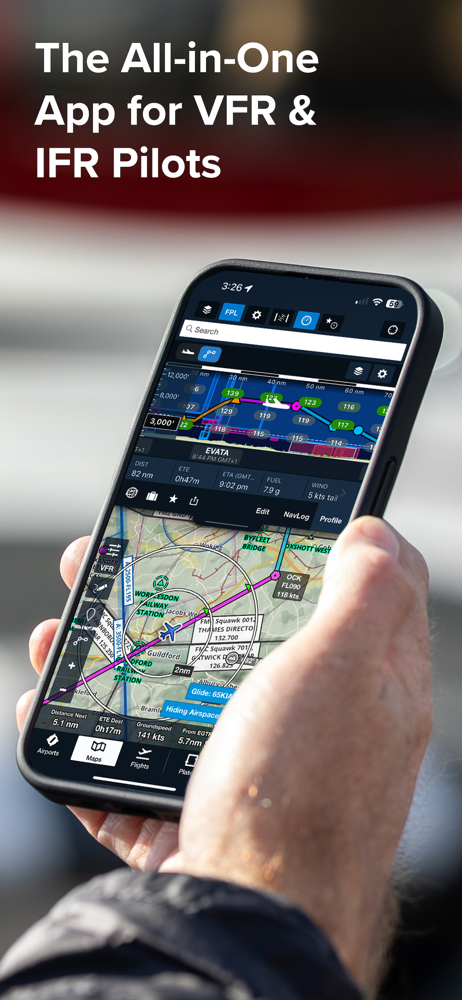
ForeFlight is the leading flight app for VFR and IFR pilots everywhere, making flight planning and flying easier, safer, and more enjoyable. From comprehensive flight planning and real-time weather updates to advanced charting and in-flight support, ForeFlight offers a suite of intuitive features to enhance your flying experience.
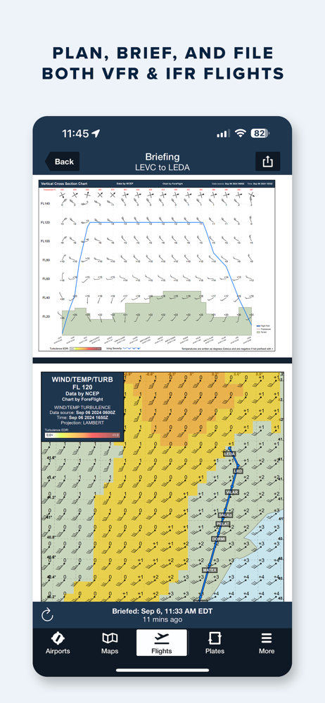
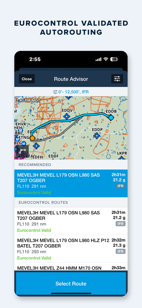
EUROCONTROL-INTEGRATED FLIGHT PLANNING, BRIEFING, & FILING
Graphical Route Advisor produces EUROCONTROL validated routes within a matter of seconds. Plan flights with Touch Planning on the Map or full-featured form-based Flights view. Tap out a route in seconds and quickly see if flights will be affected by weather or TFRs. Helpful Route, Altitude, and Procedure Advisors make planning easy and accurate. Generate a graphical preflight briefing and file your flight plan directly from the app. Print a professional-grade Navlog for inflight reference. Easily accessible airport information including frequencies, runway details, and real-time NOTAMs to help you plan your route.
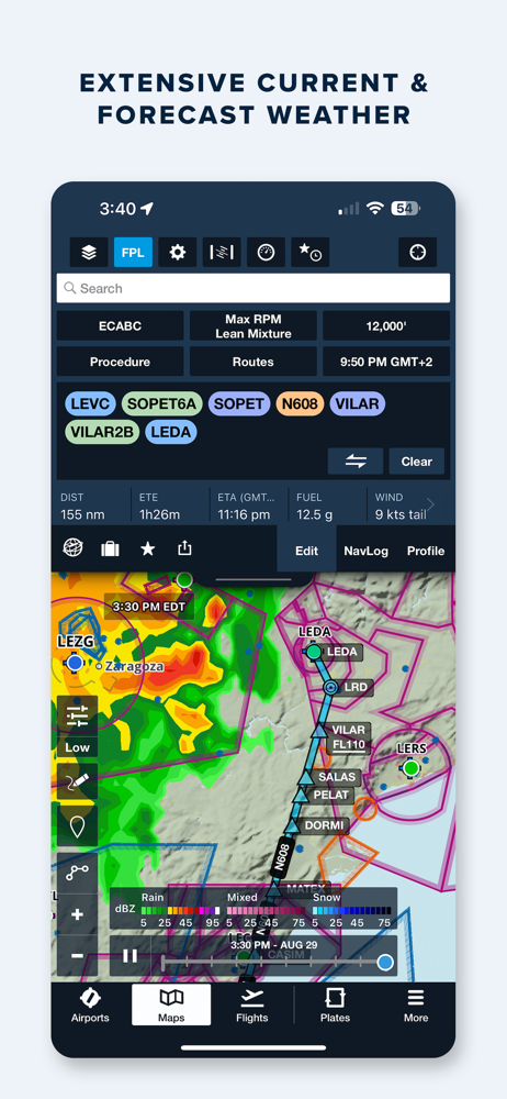
WEATHER
Interactive weather layers include animated radar, global satellite and winds aloft, global icing, turbulence, and surface analysis, graphical AIR/SIGMETs, flight category, visibility, and more. View decoded METARs, TAFs, and a 10-day general forecast. Generate a PDF briefing that combines graphical forecast charts, color-coded METARs/TAFs, and NOTAMS for your route. Thoughtfully organized Imagery view puts a full range of forecast tools at your fingertips.
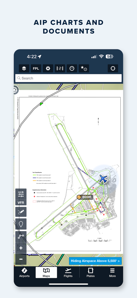
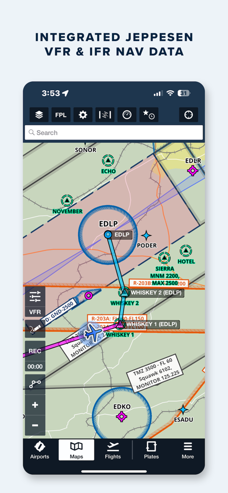
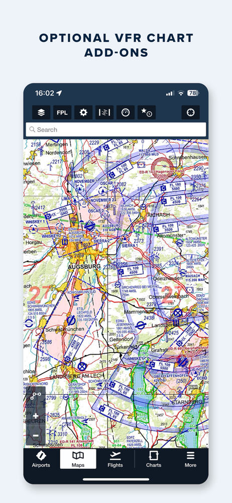
PROCEDURES, CHARTS, & MAPS
ForeFlight’s state-of-the-art map engine gives the app its signature speed and fluidity when panning and zooming. The data-driven Aeronautical map uses Jeppesen’s global navigation data to depict waypoints, airports, airspace, airways, arrival/departure procedures, circuits, holds, no overfly areas, and more to support VFR and IFR flying in Europe.
The Europe geo-region includes IFR high and low enroute charts, procedure charts and AIP documents provided via EUROCONTROL. Optional add-ons include Jeppesen IFR charts and airway manuals, Jeppesen VFR procedure charts, and a wide range of optional VFR chart add-ons from DFS, Rogers Data, Air Million, and many others
GEO-REFERENCED PROCEDURES & TAXI CHARTS
Procedure and taxi charts support real-time display of your GPS location on the chart. They can also be overlaid on the Maps view along with weather and hazards for the ultimate situational awareness.
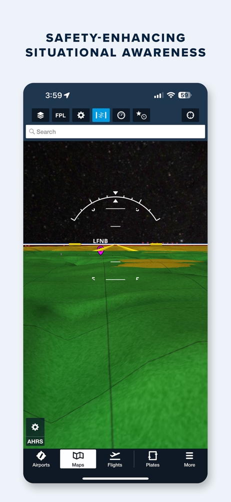
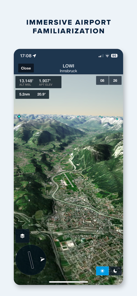
GLOBAL HAZARD AWARENESS TECHNOLOGY
Plan and fly with more confidence in all conditions and terrain. Top-down-view Hazard Advisor map layer, Terrain Profile View, and 3D Synthetic Vision seamlessly integrate into the map display to depict a clear picture of terrain and obstacle hazards anywhere in the world. When paired with an AHRS source, Synthetic Vision provides a backup attitude display.
ADDITIONAL FEATURES INCLUDE:
Built-in documents catalog with AIP documents covering all of Europe
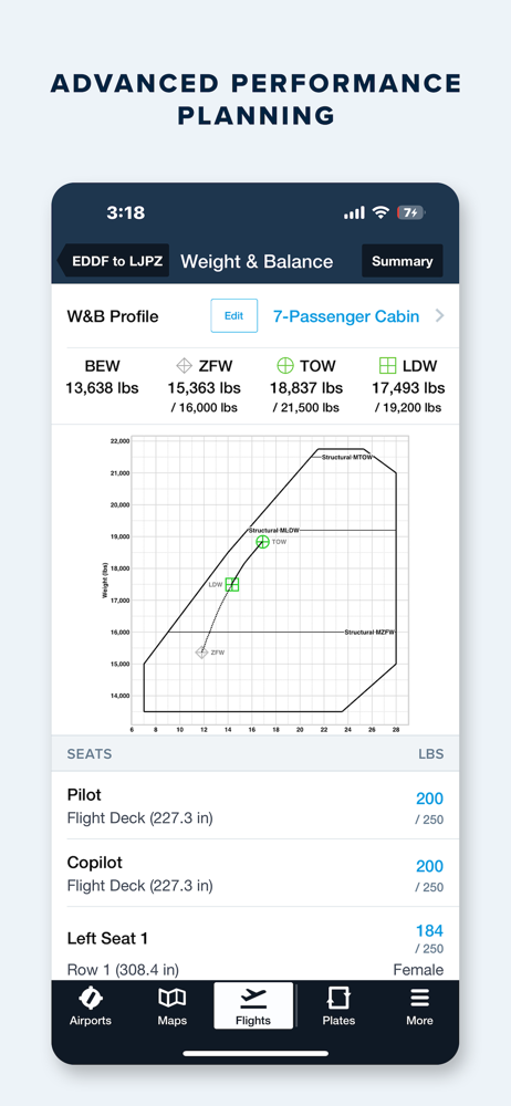
Mass & Balance calculator
Glide Advisor
Automatic chart and data updates
Chart color inversion fora better night flying experience
Access to web planner
Cockpit connectivity with popular installed and portable avionics
Detalhes da Versão
| País do Editor | BR |
| Data de Lançamento no País | 2009-12-16 |
| Categorias | Navigation, Weather |
| Países / Regiões | BR |
| Website do Desenvolvedor | ForeFlight |
| URL de Suporte | ForeFlight |
| Classificação do Conteúdo | +4 |
Avaliação Média
34
Desagregação das Avaliações
Avaliações em Destaque
Por JF_Moreira
2024-08-24
Versão
Infelizmente não dão a atenção necessária às cartas do Brasil. ARCs e cartas de rotas em baixa resolução com informações ilegíveis. Espero que implementem melhorias.
Por Tripulação da Exec.
2019-10-16
Versão 11.8.1
Completo para o planejamento. Aproveita assinatura e integra cartas Jeppesen. É possível incluir as WAC e REA do Brasil de maneira simples via ITunes. As mesmas são precisas e georreferenciadas (voo sobre a carta). Profissional.
Por paulomachado3
2024-08-01
Versão 16.7
Falta as informações de radar meteorológico no Brasil. Já informei o suporte e enviei os API tem mais de um ano e não implementaram
Capturas de Tela