Outdooractive. Hike and Ride
Outdooractive AG
4.5
Advertisement
Advertisement
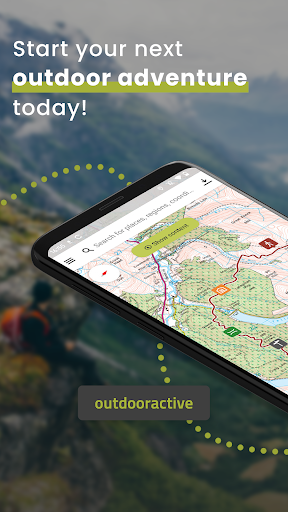
Confidently explore the great outdoors with Outdooractive - Hike and Ride: The most reliable outdoor navigation app, as trusted by thousands of trail wardens, mountain guides and outdoor industry professionals worldwide.
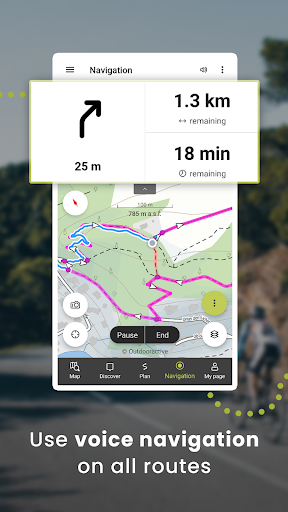
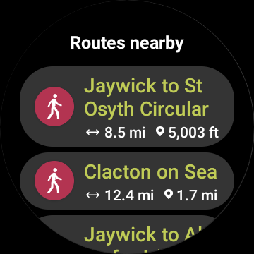
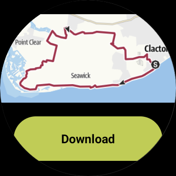
The Outdooractive - Hike and Ride app helps you find officially approved routes near you and around the world, with suggestions for dozens of sports including: hiking paths, trekking trails, mountain biking routes, trail running paths, ski touring routes and more. Or plan your own routes using the deepest catalog of official maps to take adventures into your own hands.
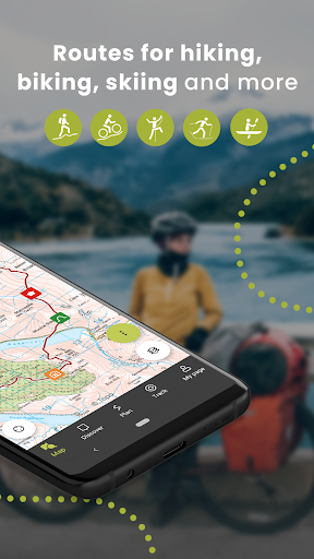
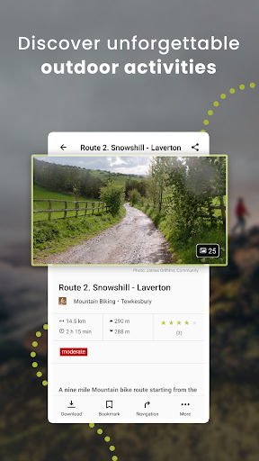
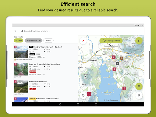
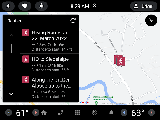
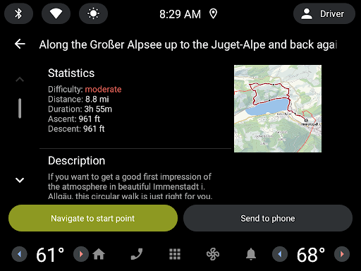
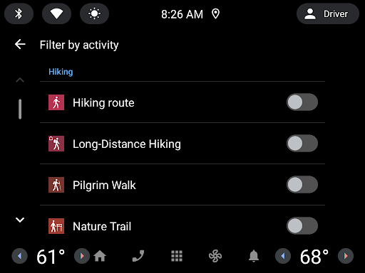
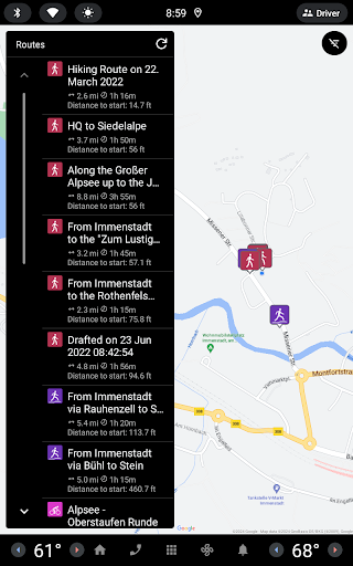
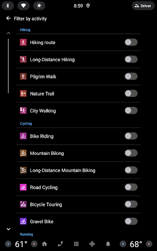
● Find routes you can rely on: Browse thousands of officially-approved routes near you and across the world, including routes for hiking, road cycling, bike touring, ski touring, gravel riding, trail running, horseback riding, mountaineering and more.
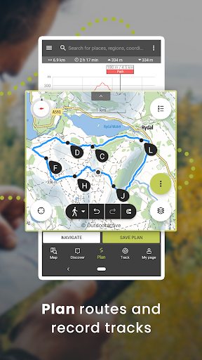
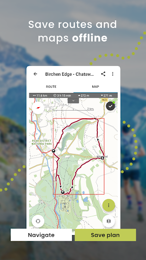
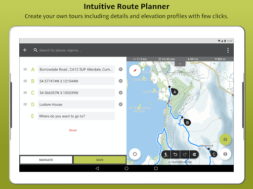
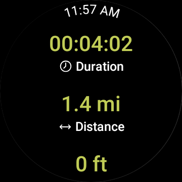
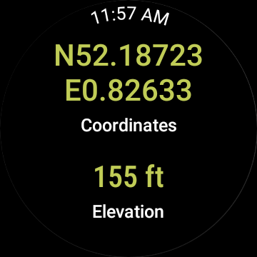
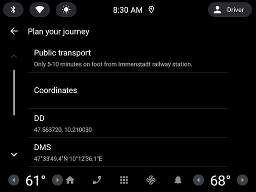
● Plan your own routes with tools trusted by professionals: Easily plot your own outdoor routes in the route planner in just a few taps, and see all need to know distance, elevation and terrain info.
● Save everything offline: Save individual plans or entire areas offline for reliable navigation when you don’t have a phone signal.
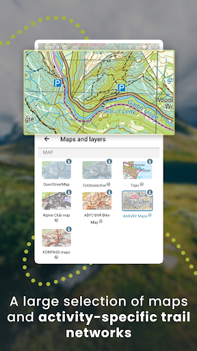
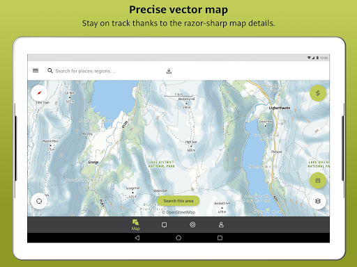
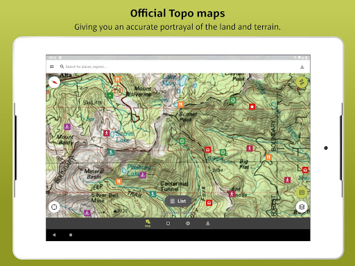
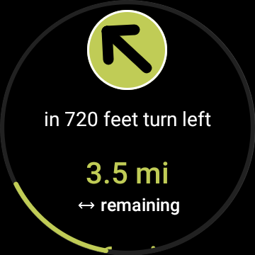
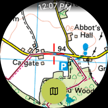
● Navigate with the most reliable maps on the planet: Browse the deepest collection of different map types to track or plan your adventures with confidence. Simply switch between different layers to get a clearer picture of the terrain you’re planning to visit, and get the most reliable understanding of conditions on the ground. Outdooractive’s map catalog currently includes:
- Official topo maps in 25 countries, including:
• Ordnance Survey (Landranger & Explorer) in the United Kingdom
• New Zealand Land Information in NZ
• USGS in the USA
• BKG in Germany
• BEV in Austria
• Swisstopo in Switzerland
• IGN in France
• CNIG in Spain
• PDOK in the Netherlands
• Kartverket in Norway
• Kortforsyningen in Denmark
• Lantmäteriet in Sweden
• Finland National Land Survey in Finland
• GSI in Japan
• Harvey Maps in the UK’s most mountainous areas
- The official Alpine Club maps for climbing in the Alps
- The specially-designed Outdooractive map across France, Germany, Austria and Switzerland.
● Share your live location with family and friends: Give yourself and your loved ones complete peace of mind when you’re out in the great outdoors thanks to BuddyBeacon.
● Join a global community of outdoor tourists and adventurers: Share your activities with the community, join challenges to stay motivated, and get inspired by officially-approved content from our thousands of industry partners.
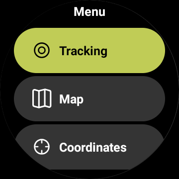
● Smartwatches with WEAR OS from Google: With a glance at your Smartwatch, you get information about your GPS position on the map. You can record tracks, get tracking data and navigate along routes.
FAQs:
Can Outdooractive find walking trails near me?
Outdooractive helps you find walking, hiking, cycling and many more types of trails both in your area, and around the world.
How can I find hiking trails near me?:
Using Outdooractive, you’re able to find hiking trails in your local area by opening our app and browsing the map. You’ll be able to see hiking trails with a range of distances, difficulties and distance from your location.
How do I know which hiking trails close to me are best to follow?:
Using Outdooractive’s multiple map layers, you’re able to view official information from multiple sources, to inform you about trail conditions, rules, restrictions and what to expect on your hike. Experts will share information on each route on its difficulty, required experience level and more!
Can I download offline maps to navigate nature walks and areas to hike near me?:
Outdooractive allows you to download maps and routes to your device before heading out, to help you navigate those areas where signal isn’t guaranteed — allowing you to reliably navigate the outdoors.
Detalhes da Versão
| País do Editor | US |
| Data de Lançamento no País | 2018-08-16 |
| Categorias | Travel & Local |
| Países / Regiões | US |
| Website do Desenvolvedor | Outdooractive AG |
| URL de Suporte | Outdooractive AG |
| Classificação do Conteúdo | Everyone |
Avaliação Média
59.63K+
Desagregação das Avaliações
Avaliações em Destaque
Por Frank Kennedy
2022-08-19
Versão 3.9.11
AdsDeviceDifficultHate itInaccurateLove itUtterly impossible to figure out. Help files are completely wrong. The buttons and menus shown in the help do not exist. There is no distinct between the desktop and phone app help, so neither is ever correct. Even showed a T...p ad! Absolutely disgusting. And of course their response to this review is the boilerplate "email service" which means , "Go away. We do not care about ViewRanger lovers." Terrible replacement for ViewRanger.
Por Jeff Zaleski
2022-03-05
Versão 3.8.9
Hate itLocationSpendingTerrible both in form and function. Used VR until the day it was shut down, then cursed this "replacement" for the next 3 days of hiking. It would randomly zoom out to continent scale and stop tracks. Distance traveled has been moved to a small status bar and only displays ft/m units, which is worthless on a multi-mile hike. So much more that just doesn't make sense for the backcountry user. Will gladly pay subscription fees for CalTopo to get a usable GPS interface.
Por Blake Veit
2022-03-30
Versão 3.9.0
Battery UsageConfusingDifficultI made the trip over from ViewRanger, as many of us did, excited for a fresh face only to find an overly complicated and inferior app. Features I used often were quick and easy to access. Now I can't even find those features. Why is this harder to use than a TSA prescreening? And on top of that they want to charge a bunch of money for the privilege? Good luck with that... Thanks for ruining a perfectly good product.
Capturas de Tela